The Land the Glaciers Missed: Wisconsin's Driftless Area
While ice sheets bulldozed the rest of the state flat, a rugged corner of southwest Wisconsin kept its ridges, coulees and cold spring creeks — and became one of America's quiet wonders.
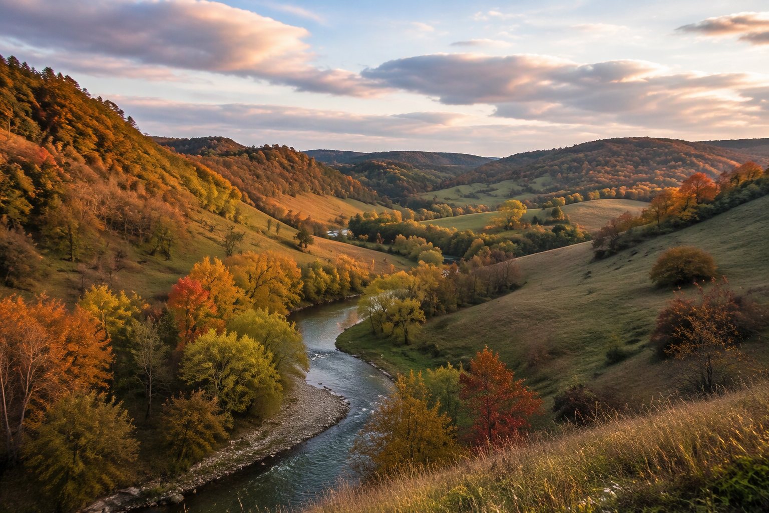
Stand on a ridgetop in Vernon or Crawford County and the land does something un-Wisconsin-like: it rises and falls in long, forested waves, dropping into narrow valleys the locals call coulees. You are in the Driftless Area — the part of the state the glaciers never touched.
Over the past two and a half million years, continental ice sheets repeatedly covered most of Wisconsin, scraping it smooth and leaving behind the lakes, eskers and drumlins that define the rest of the state. But a lobe-free pocket of roughly 24,000 square miles across southwest Wisconsin, southeast Minnesota, northeast Iowa and northwest Illinois stayed ice-free.
Without glacial 'drift' — the gravel and till the ice leaves behind — the region kept its ancient topography: steep sandstone and dolomite ridges, deep valleys cut by spring-fed streams, and some of the most dramatic scenery in the Midwest.
The most beautiful corner of Wisconsin may be the one the Ice Age forgot.
Those cold, spring-fed coulee streams made the Driftless Area a destination for one particular tribe: trout anglers. Its thousands of miles of Class I trout water draw fly fishers from across the country, and Wisconsin's decades of stream restoration work there are a national conservation success story.
The region's human character is distinctive too — Norwegian-American valleys, organic and Amish farms, apple orchards along the ridges, and small river towns like Viroqua that have become unlikely centers of the local-food movement.
For Madisonians, the Driftless begins less than an hour west. Pick a ridge road off Highway 14 in October, when the coulees turn color, and the case makes itself: the most beautiful corner of Wisconsin is the one the Ice Age forgot.